Aerial Survey Kerala: Complete Guide to Drone Mapping, LiDAR & Photogrammetry
Whether you're planning a road, mapping a panchayat, assessing flood risk, managing utility infrastructure, or monitoring a construction project — you need accurate spatial data of your site. Aerial survey using drones delivers that data faster, safer, and more cost-effectively than any ground-based method for areas above 5 hectares. This complete guide covers everything you need to know about aerial drone survey in Kerala: the technology, the process, the deliverables, the cost, and how to choose the right company.
📸 Add project photo here
Suggested: Wide aerial orthomosaic view of Kerala — panchayat mapping or power utility corridor survey
Types of Aerial Survey in Kerala
1. Photogrammetry Survey (RGB Drone)
The most common type — a drone with high-resolution camera flies a grid pattern capturing overlapping images. Processed using Pix4D or Agisoft Metashape to produce: orthomosaic (aerial map), DEM/DSM, contour lines, and 3D point cloud. Best for: open terrain, urban mapping, construction monitoring, corridor documentation.
2. UAV LiDAR Survey
A drone carrying a LiDAR (Light Detection and Ranging) sensor emits laser pulses to measure 3D terrain. LiDAR penetrates through tree canopy to measure actual ground — essential for Kerala's forested Western Ghats terrain, transmission line corridors, and flood modelling under vegetation cover. Best for: forested areas, transmission corridors, high-accuracy terrain modelling, mining volumes.
3. Thermal Drone Survey
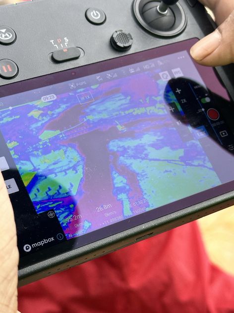
Infrared sensor captures heat signatures across the survey area. Used for: solar panel defect detection, powerline hotspot identification, building energy audits, wildfire monitoring. Dronimagination completed thermal survey for IREDA solar plant inspection.
4. DGPS / RTK Ground Survey (Supporting Role)
Ground control points established by DGPS are the accuracy foundation of aerial survey — not a standalone aerial method, but essential for achieving centimetre-level accuracy in drone outputs. Dronimagination includes DGPS GCP establishment in all high-accuracy survey projects.
Dronimagination's Aerial Survey Projects in Kerala
With 3,000+ sq km of aerial survey experience and a 24-person team, Dronimagination has executed aerial survey across every terrain type in Kerala:
| Client | Project | Survey Type |
|---|---|---|
| Local self-government departments | Municipal Asset Mapping (2,000+ sq km) | LiDAR + RGB |
| Kerala's power utility | Chittur-Palakkad Transmission Line | UAV LiDAR |
| Kerala's power utility | Muthirapuzha PSP 1000 MW | LiDAR + DGPS |
| Kerala's disaster management department / District Collector | NIT Calicut Mesoscale Landslide Zone | LiDAR + RGB |
| ICFOSS | Technopark Campus Flood Modelling | LiDAR DEM |
| WRPM Consultants | Eangandiyur Flood Modelling | Aerial LiDAR + DGPS |
| National highway authority contractors | Highway Corridor Video + Orthomosaic | RGB Corridor |
| A quarry operator in Kerala | Quarry Volumetric Analysis | LiDAR + DGPS + Sonar |
📸 Add project photo here
Suggested: Team in field — DGPS GCP setup before drone flight / drone launch for survey mission
Aerial Survey Cost Guide for Kerala (2026)
- RGB photogrammetry (open terrain): ₹500–₹1,500/hectare
- RGB photogrammetry + contours + GIS output: ₹1,500–₹3,000/hectare
- UAV LiDAR (terrain only): ₹2,000–₹4,000/hectare
- UAV LiDAR + DEM/DTM + GIS processing: ₹3,000–₹6,000/hectare
- Corridor survey (LiDAR/RGB): ₹8,000–₹25,000/km depending on width and terrain
- Full GIS portal integration: Quoted based on scope
These are indicative ranges. Actual pricing depends on site accessibility, terrain complexity, CORS availability, and specific deliverable requirements. All Dronimagination quotes include DGPS ground control establishment, processing, and final GIS deliverables.
How to Choose an Aerial Survey Company in Kerala
Key factors to evaluate:
- DGCA certification: All commercial drone operations in India require DGCA-certified RPC pilots. Verify the company holds valid Remote Pilot Certificates — Dronimagination's pilots are DGCA certified
- Equipment capability: Ensure the company has RTK-enabled drone platforms and professional LiDAR sensors — not consumer-grade equipment
- GIS processing in-house: Companies that outsource processing have less quality control and longer timelines. Dronimagination processes all survey data in-house with a dedicated 8-person GIS team
- Government project experience: Government projects have strict accuracy and documentation requirements. Dronimagination's track record with Kerala's power utility, local government bodies, Kerala's disaster management department, and national highway authorities demonstrates this capability
- Certified surveyor: For projects requiring legal boundary coordinates, ensure the company has a certified surveyor — Dronimagination includes a Government of India approved certified surveyor on the team
Looking for an Aerial Survey Company in Kerala?
Share your project details — area, location, terrain type, and required deliverables. Dronimagination provides a detailed scope and quote within 48 hours.
Request an Aerial Survey Quote →📸 Add project photo here
Suggested: Final deliverable output — orthomosaic + contour overlay or 3D terrain visualization
Conclusion
Aerial survey using drones has become the standard data acquisition method for government mapping, infrastructure planning, and environmental assessment in Kerala. With 3,000+ sq km of completed surveys and a full-stack team covering piloting, DGPS, LiDAR processing, and GIS — Dronimagination is Kerala's most experienced aerial survey provider, capable of handling projects from a single panchayat ward to multi-district government initiatives.
Explore specific survey types: UAV LiDAR applications, topographical survey, DGPS survey. Contact Dronimagination for your Kerala aerial survey project.
Need professional drone survey services in Kerala?
View Survey Solutions →