Kerala's terrain — dense rubber and teak plantations, Western Ghats forest cover, steep laterite hillsides — demands LiDAR. Only laser-based scanning penetrates canopy to deliver the bare-earth terrain models needed for flood modelling, power line clearance, and corridor surveys.
Over 54% of Kerala's land area is under forest, plantation, or dense vegetation cover. A drone camera — no matter how high-resolution — sees the top of the canopy. The terrain below is invisible.
Photogrammetry produces a DSM (Digital Surface Model) — the top of everything it can see. For a rubber plantation or a teak forest, that DSM maps the tree tops, not the ground. Flood models built on DSM data show water flowing 15 metres above the actual ground surface.
LiDAR solves this. Laser pulses reach up to 1,000,000 points per second, many of which slip through canopy gaps to hit the bare ground. The resulting classified point cloud separates ground from vegetation — enabling a true DTM (Digital Terrain Model) even under dense forest cover.
Where Dronimagination uses LiDAR in Kerala
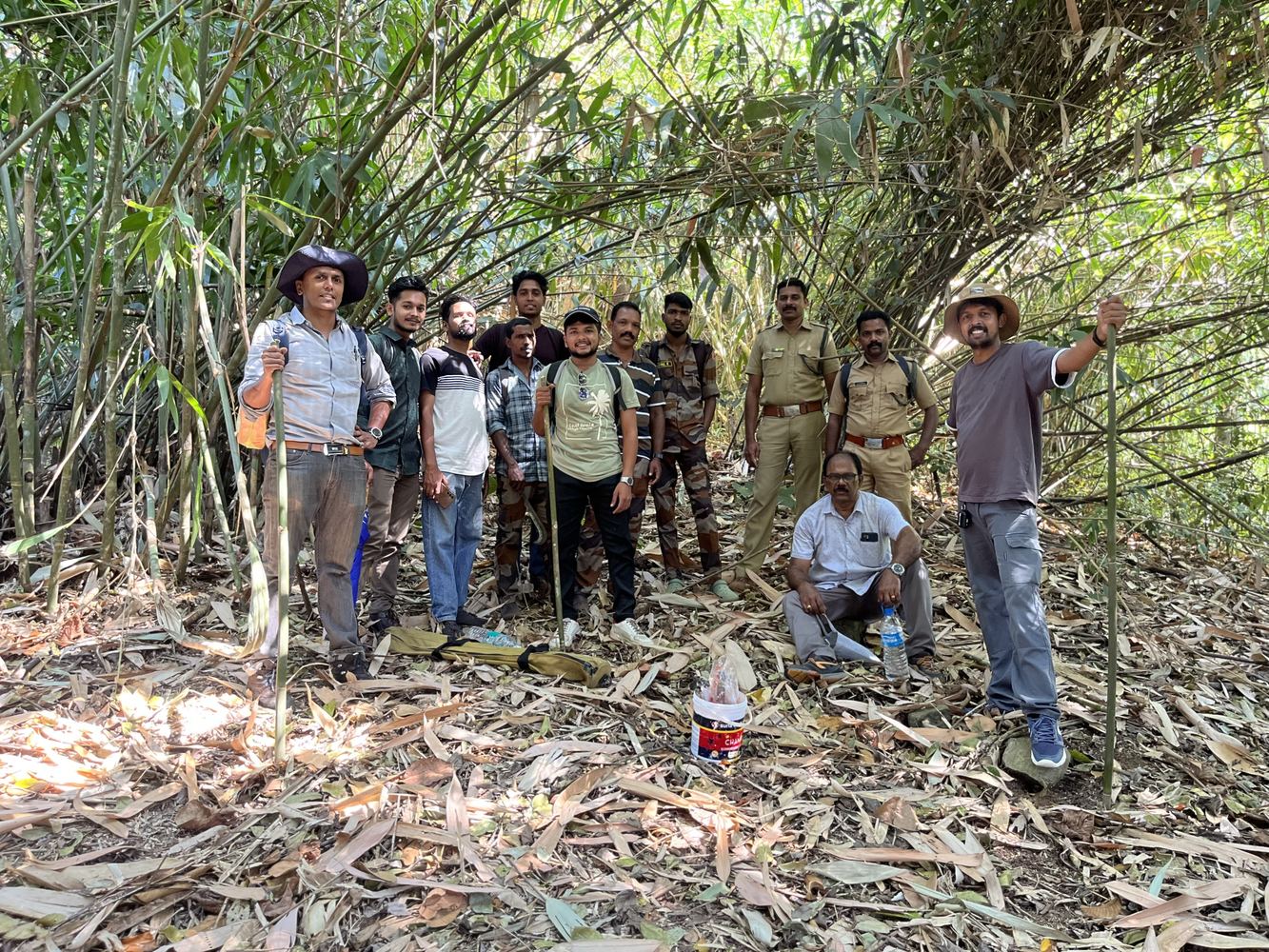
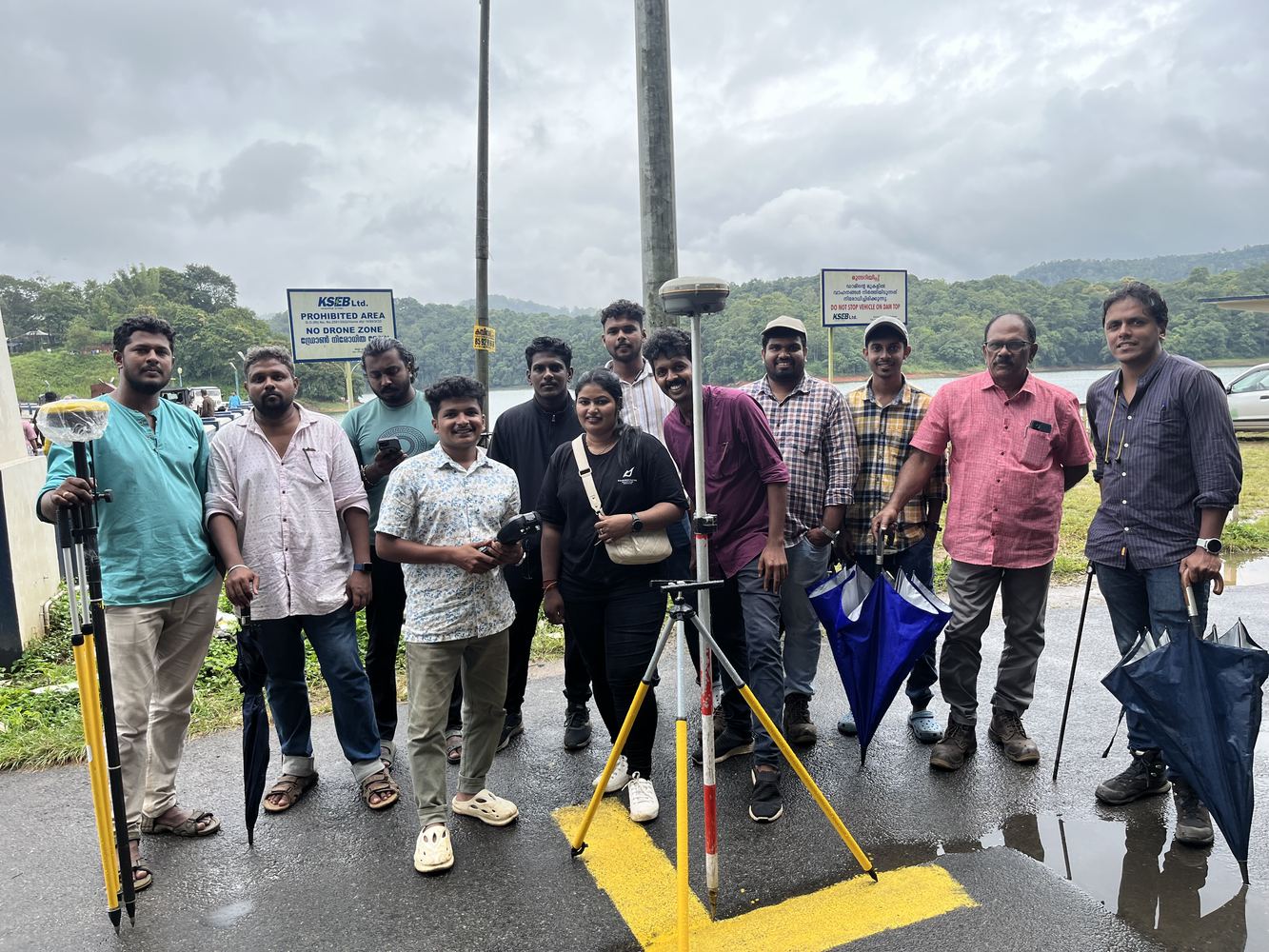
▸KSEB power line corridors — Mankulam, Vellathooval. Vegetation clearance analysis in forested mountain terrain with no road access.
▸WRPM flood modelling — bare-earth DTM for Kerala's Water Resources Planning Mission hydraulic models.
▸Wayanad & Vilangad landslide hazard mapping — NIT Calicut research collaboration using LiDAR DTM for slope stability analysis.
▸Topographic survey in plantation areas — where traditional total station survey takes months and photogrammetry gives no ground data.
LiDAR Survey Applications
What We Survey With LiDAR in Kerala
⚡
Power Line Corridor Survey
Vegetation clearance mapping, conductor sag measurement, and encroachment detection for KSEB and private power utilities. LiDAR classifies conductors, towers, and vegetation independently to compute exact clearance distances. Statutory compliance documentation included.
🌊
Flood Modelling & DTM
Bare-earth DTM generation for hydraulic flood modelling across Kerala's river catchments and coastal lowlands. LiDAR-derived DTMs feed directly into HEC-RAS flood simulation, producing accurate flood extent maps, water depth rasters, and evacuation zone boundaries.
🏔️
Western Ghats Terrain Mapping
High-resolution topographic survey of steep forested slopes in Idukki, Wayanad, Palakkad, and Malappuram districts. Used for landslide hazard analysis, watershed delineation, forest inventory, and infrastructure planning in ecologically sensitive zones.
🛣️
Highway & Railway Corridor
Long-corridor topographic surveys for NHAI highway projects, railway alignment studies, and pipeline routes across Kerala. LiDAR delivers cross-sections at 5–20 m intervals, longitudinal profiles, and earthwork volume calculations — all from a single flight mission.
🌿
Forest & Plantation Survey
Canopy height models (CHM) for rubber, teak, eucalyptus, and cardamom plantations. Forest inventory metrics including tree height, crown area, and biomass estimation. Individual tree detection possible at high point densities (50+ pts/m²). Used for forest departments and private plantation management.
🏗️
Mining & Volume Calculation
Pre- and post-extraction volume calculations for quarries, mining sites, and earthwork projects. LiDAR point cloud delivers volumetric accuracy superior to photogrammetry for large irregular stockpiles. Used for royalty compliance reporting and contractor payment verification.
🏛️
Heritage & Archaeological Survey
3D documentation of heritage structures, ancient temples, and archaeological sites across Kerala using LiDAR. Millimetre-level surface detail capture for conservation planning, structural assessment, and digital archiving — including sites where photogrammetric access is restricted.
🌧️
Disaster Response & Hazard Mapping
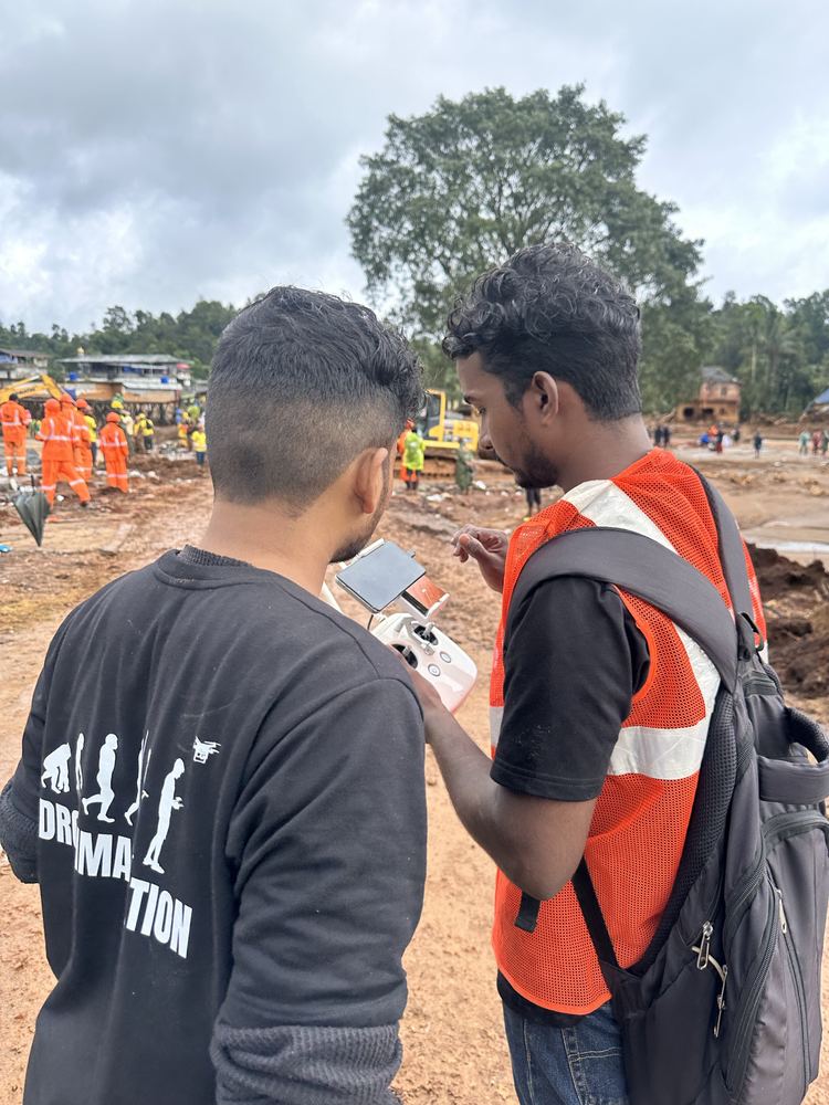
Post-event terrain change detection, landslide volume estimation, and slope stability analysis using LiDAR. Dronimagination deployed drone survey for the Wayanad Landslide 2024 — producing terrain and hazard maps used by NDRF and district administration for rescue coordination.
🔬
Research & Academic Collaboration
LiDAR data provision and processing for NIT Calicut, KFRI (Kerala Forest Research Institute), and ICFOSS research projects. Published research collaborations in landslide hazard mapping (Wayanad, Vilangad) and terrain analysis for Western Ghats geohazard studies.
Kerala LiDAR Projects
LiDAR Survey Projects Delivered in Kerala
Power Utility
KSEB Mankulam — Power Line LiDAR Corridor Survey
UAV LiDAR corridor survey for Kerala State Electricity Board across the Mankulam transmission line corridor — deep forested mountain terrain with no road access. LiDAR point cloud used for vegetation clearance analysis, conductor sag measurement, and encroachment detection.
Client: KSEB — Kerala State Electricity Board · Method: UAV LiDAR · Location: Mankulam, Idukki
Power Utility
KSEB Vellathooval — Forest Corridor LiDAR Survey
LiDAR corridor mapping for KSEB in the Vellathooval forest region. Dense Western Ghats canopy required LiDAR to obtain ground surface and vegetation clearance data beneath the tree canopy. Deliverables: classified point cloud, vegetation clearance raster, and compliance report.
Client: KSEB — Kerala State Electricity Board · Method: UAV LiDAR · Location: Vellathooval, Idukki
Government
WRPM — LiDAR DTM for Flood Modelling
Bare-earth DTM generation from UAV LiDAR for Kerala's Water Resources Planning Mission hydraulic flood modelling project. LiDAR bare-earth data fed into HEC-RAS to produce flood inundation extent maps for Kerala river basins — critical for post-Wayanad disaster planning.
Client: WRPM — Water Resources Planning Mission · Method: UAV LiDAR + DTM · Location: Kerala
Research
NIT Calicut — Wayanad & Vilangad Hazard Mapping
LiDAR terrain survey in Wayanad and Vilangad districts for landslide hazard analysis research in collaboration with NIT Calicut. High-resolution LiDAR DTM used for slope gradient, curvature, and contributing area calculations for published hazard zonation studies.
Fully classified point cloud: Ground, Low/Medium/High Vegetation, Building, Water, Power Lines, Unclassified. Delivered in LAS 1.4 or LAZ compressed format. Compatible with ArcGIS, QGIS, CloudCompare, Terrasolid.
Bare-Earth DTM (GeoTIFF)
Ground-only terrain model at 0.25 m, 0.5 m, or 1 m resolution as required. Used directly for flood modelling, slope analysis, and volumetrics. Delivered in WGS84 or Kerala State plane coordinate system.
DSM — Digital Surface Model
First-return surface model representing the top of all features — buildings, trees, structures, and terrain. Used for urban planning, viewshed analysis, and shadow studies.
Canopy Height Model (CHM)
For plantation and forest projects: CHM = DSM − DTM, delivering individual tree height and crown mapping. Point density of 50+ pts/m² enables individual tree detection.
Contour Maps
Contour lines at 0.5 m, 1 m, or 2 m intervals derived from the LiDAR DTM. Delivered in DXF/DWG (AutoCAD), SHP (GIS), or PDF format. Suitable for tender and design submissions.
Cross-Sections & Profiles
For corridor projects: cross-sections at user-specified intervals (5–50 m). Longitudinal profile along centreline. Earthwork volume calculations for cut and fill. DXF and CSV output.
Vegetation Clearance Report
For power line projects: minimum clearance distance raster between conductors and vegetation. Encroachment risk zones identified and mapped. Statutory compliance report for KSEB/PGCIL requirements.
Accuracy Report & Flight Log
Full accuracy report with RMSE against check points (not GCPs). Flight log, sensor calibration certificate, and coordinate reference system documentation. Suitable for third-party QC and tender compliance verification.
Choose the Right Method
LiDAR vs Photogrammetry — Which Do You Need?
Dronimagination recommends the right method for your project — sometimes both.
Parameter
UAV LiDAR
Photogrammetry
Works under vegetation canopy
Yes — penetrates canopy gaps to reach bare ground
No — maps top of canopy only
Bare-earth DTM in forest
Accurate — classified ground returns
Not possible under dense cover
Point density
50–200+ pts/m²
100–500+ pts/m² (but surface model only)
Vertical accuracy
3–5 cm RMSE
2–8 cm RMSE (open terrain only)
RGB visual imagery
Not standard (LiDAR only)
Yes — high-resolution orthomosaic
Best for Kerala
Forested areas, power line corridors, flood modelling, Western Ghats
Open land, construction sites, urban areas, agriculture
Based in Ernakulam — we mobilise to any district in Kerala within 24 hours.
Ernakulam / KochiHQ · Urban & Port
IdukkiKSEB · Plantation · Forest
WayanadDisaster · Hazard · Forest
KozhikodeNIT Research · Urban
ThrissurInfrastructure · Agri
PalakkadCorridor · KSEB
MalappuramTerrain · Forest
AlappuzhaFlood Modelling · Water
PathanamthittaRiver · Watershed
KottayamPlantation · Rubber
KannurCorridor · Coastal
ThiruvananthapuramUrban · Govt
Common Questions
LiDAR Survey Kerala FAQ
What is UAV LiDAR survey and how does it work in Kerala?
UAV LiDAR uses laser pulses fired from a drone-mounted scanner to measure the distance to the ground at up to 1,000,000 points per second. Unlike photogrammetry, LiDAR pulses can penetrate gaps in vegetation canopy to reach the bare ground below — making it ideal for Kerala's heavily forested Western Ghats, plantation areas, and riverine terrain. The result is a classified 3D point cloud that separates ground, vegetation, and structures, from which a bare-earth DTM is derived — the foundation for flood modelling, corridor surveys, and volume calculations under forest cover.
Why is LiDAR better than photogrammetry for Kerala terrain?
Kerala's terrain — dense rubber and teak plantations, Western Ghats forests, and steep laterite hillsides — presents a fundamental problem for photogrammetry: drone cameras cannot see through the vegetation canopy to map the ground surface. Photogrammetry produces a DSM (Digital Surface Model) that maps the top of the tree canopy, not the ground. LiDAR solves this by firing laser pulses that slip through gaps in the canopy to hit the actual ground. For flood modelling, power line corridor clearance, and terrain analysis in forested areas, LiDAR is the only reliable method.
What is the cost of LiDAR survey in Kerala?
LiDAR survey cost in Kerala depends on area, terrain, and point density requirement. Typical pricing: UAV LiDAR survey ₹8,000–₹20,000 per hectare for standard projects. Corridor surveys (power lines, highways) are priced per km based on corridor width and point density. High-density LiDAR (100+ pts/m²) for engineering projects is priced separately. Contact Dronimagination with your project area, location, and accuracy requirement for a detailed quote within 24 hours.
What deliverables do I get from a LiDAR survey in Kerala?
Standard LiDAR deliverables include: Classified LiDAR point cloud (LAS/LAZ), Bare-earth DTM (GeoTIFF, 0.25–1 m resolution), DSM (Digital Surface Model), Canopy Height Model for forest projects, Contour maps at specified intervals, Cross-sections and longitudinal profiles for corridor projects, Vegetation clearance analysis for power line corridors, 3D visualisations, and a full accuracy report with RMSE documentation and flight report. All data is delivered in the client's preferred coordinate reference system (WGS84, state plane, or local datum).
Which Kerala projects has Dronimagination completed using LiDAR?
Dronimagination has completed LiDAR projects across Kerala including: KSEB power transmission line corridor surveys in the Mankulam and Vellathooval regions (dense forested mountain terrain); WRPM flood modelling using bare-earth LiDAR DTM; NIT Calicut research collaboration for landslide hazard mapping in Wayanad and Vilangad; and multiple topographic surveys in Wayanad district following the 2024 landslide disaster response.
How accurate is UAV LiDAR survey?
UAV LiDAR surveys by Dronimagination achieve vertical accuracy of 3–5 cm (RMSE) and horizontal accuracy of 5–10 cm under standard conditions. For engineering-grade projects using high point density (100+ pts/m²) with CORS-integrated ground control, vertical accuracy reaches 2–3 cm. Accuracy is verified against independently surveyed check points before delivery, and full RMSE documentation is included in every survey report.
What is LiDAR corridor mapping and why is it used for power lines in Kerala?
LiDAR corridor mapping surveys a narrow linear strip — typically 100–500 m wide — along power lines, highways, railways, or pipelines. For KSEB power utility, LiDAR corridor surveys are used to measure exact vegetation clearance distances (statutory compliance), identify encroachment risks, plan vegetation management, and produce as-built documentation for transmission lines across Kerala's hilly terrain. Dronimagination has completed KSEB corridor surveys in Mankulam and Vellathooval — areas with no road access and steep elevation change where ground survey was not feasible.
Does Dronimagination do LiDAR flood modelling in Kerala?
Yes. Accurate flood modelling requires a bare-earth DTM — the ground surface without buildings or vegetation. In Kerala's forested catchment areas, this is only achievable with LiDAR. Dronimagination has delivered LiDAR-derived DTMs for flood modelling projects including work for Kerala's Water Resources Planning Mission (WRPM). The DTM feeds into HEC-RAS or equivalent hydraulic modelling software to simulate flood extents, water depths, and evacuation zone planning.